TrueView 680 Traditional + Software
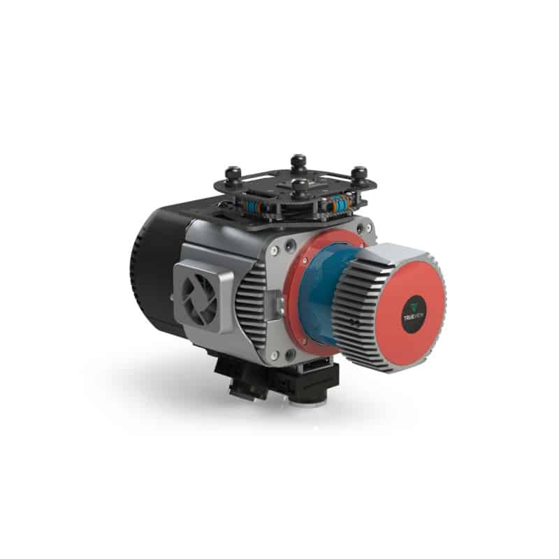
The TrueView 680 is a premium LiDAR and imaging system built for professionals who require high-accuracy aerial data collection. Featuring the powerful RIEGL VUX-1UAV sensor, it provides survey-grade precision and long-range scanning capabilities, making it ideal for complex mapping projects. The system’s dual 20 MP cameras enhance photogrammetry applications, producing high-resolution RGB imagery and colorized point clouds. Optimized for UAV deployment, the TrueView 680 is a versatile solution for industries such as energy, construction, and environmental monitoring.
Key Features:
- High-Precision LiDAR Scanning – Utilizes the RIEGL VUX-1UAV for long-range, high-accuracy data collection.
- Dual 20 MP Cameras – Captures high-resolution RGB imagery for photogrammetry and colorized point clouds.
- Optimized for UAVs – Designed for seamless integration with drone platforms for efficient data collection.
- Advanced Data Processing – Compatible with LP360 software for automated classification, feature extraction, and analysis.