Your cart is currently empty!
The “One-Stop-Shop Drone” for Surveying. Check out the all new WingtraRAY.
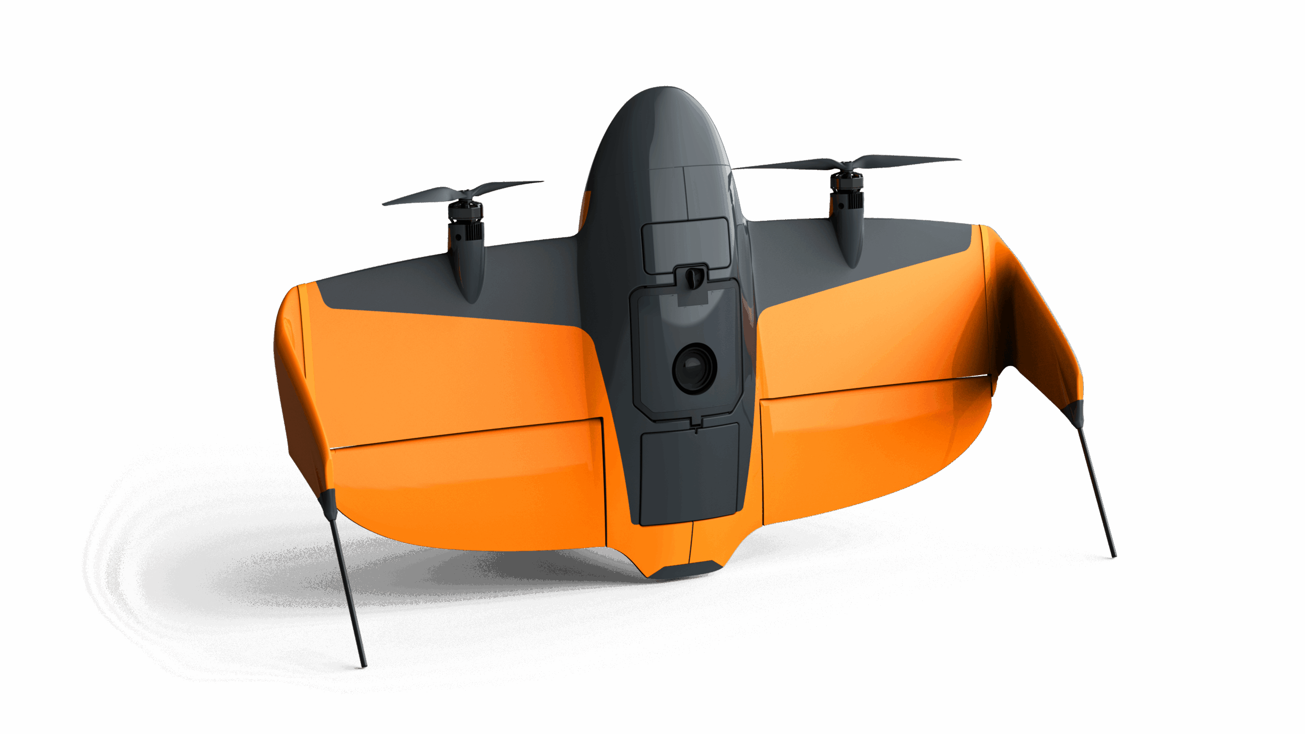
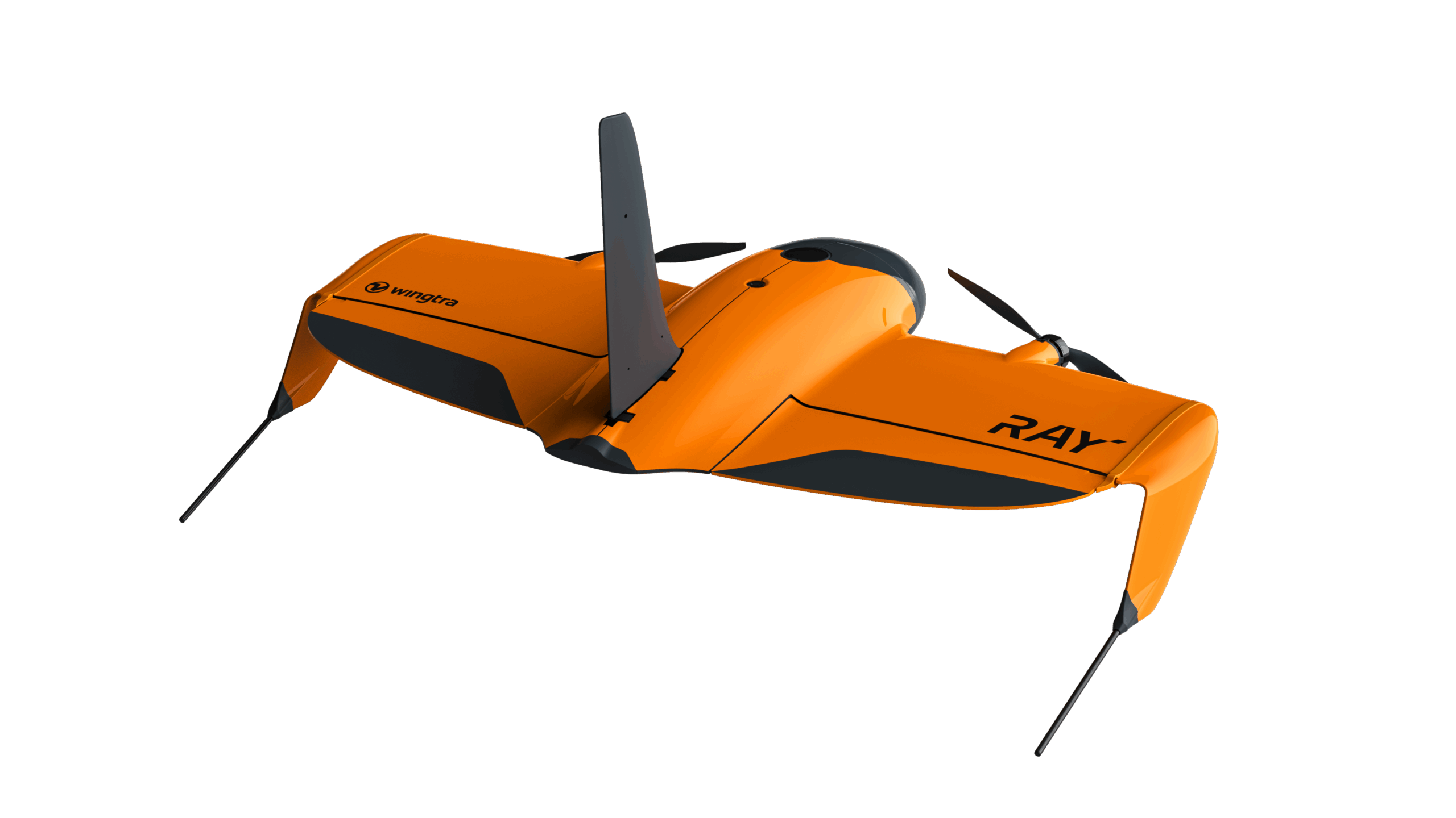
WingtraRAY
WingtraRAY redefines aerial surveying by guaranteeing mission success on the very first flight—whether you’re navigating tight urban corridors or vast rural expanses—while dramatically cutting turnaround times and operational overhead. Its modular, all-in-one design scales effortlessly from millimeter-level inspections to large-area mapping, so you can serve more clients and tackle a wider range of projects with…
Description
WingtraRAY redefines aerial surveying by guaranteeing mission success on the very first flight—whether you’re navigating tight urban corridors or vast rural expanses—while dramatically cutting turnaround times and operational overhead. Its modular, all-in-one design scales effortlessly from millimeter-level inspections to large-area mapping, so you can serve more clients and tackle a wider range of projects with a single versatile platform.
- Peace of mind: Confidence you’ll get it right the first time, in rural and urban environments
- Cost Effective: The fastest most reliable way to deliver survey data
- One tool, more jobs: Serve more customers and applications—from fine detail and mm resolution to full-scale projects—with one solution
MAP61
Engineered for large‐scale, high-resolution 2D mapping and 3D modeling, the MAP 61 camera dramatically shortens mission time in the field. Thanks to its oblique 61 MP sensor, fast capture speed, and optimized image overlap, you can capture extensive areas in detailed 3D maps quickly without compromising on quality.
SURVEY61
For survey‐grade photogrammetry and high‐precision mapping, SURVEY61 offers a 61 MP nadir RGB sensor with a low distortion lens enabling aerial surveying in high resolution — featuring GSD down to 0.5 cm/px. Perfect for urban planning and construction, it provides survey-grade accuracy from 120 m AGL without the need of Ground Control Points (GCPs). Covering up to 310 ha at 120 m (1.3 cm/px GSD), it also ensures efficient data capture for projects of all scales while retaining exceptional detail.
INSPECT
When you need the highest resolution for close‐up inspections, INSPECT delivers. Its 61 MP nadir camera with fast trigger speed coupled with a high-quality tele lens enables millimeter‐level detail for critical infrastructure checks in railways, airfields, and similar applications down to 0.25 cm/px GSD. With coverage of up to 100 ha at 120 m (0.5 cm/px GSD), INSPECT outperforms other aerial solutions by factors in terms of field efficiency and delivers ultra‐sharp detail for thorough asset evaluations.
SURVEY24
The SURVEY24 payload is an accessible choice for organizations seeking accurate yet cost‐effective surveying solutions. With a nadir RGB sensor designed for photogrammetry, it offers good precision and covers up to 330 ha at 120 m (at 2.4 cm/px GSD). This balance of affordability and performance makes SURVEY24 well‐suited for general surveying tasks that demand reliable accuracy.
MicaSense RedEdge-P
A powerful multispectral payload for advanced vegetated area analytics, RE-P combines high‐resolution multispectral and RGB imaging in a single streamlined system. Its 5.1 MP panchromatic sensor, operating at up to three frames per second, reveals crucial details in forestry, agriculture, and environmental research—helping users track plant health, monitor crop productivity, and observe ecological changes. With a GSD down to 2 cm/px, RE-P delivers the precision and data quality needed for confident decision‐making in a wide range of green‐focused industries.
LIDAR
Capture detailed elevation data even through dense vegetation for advanced terrain modeling and topographical analysis with Wingtra’s LIDAR sensor – a high-performance aerial scanning solution within a streamlined surveying workflow. With point densities up to 200 points/m², it excels in mining, construction, urban planning, and environmental monitoring.
Related products
-
SkyScout Pro w/ Black Herelink
$10,000.00 -
SkyScout Pro +
$27,384.00 -
Ranger Pro 1100 with Blue Herelink
$28,125.00 -
DJI Mavic 3 Thermal
-
DJI Matrice 30T (Thermal)
Reviews
There are no reviews yet.