Your cart is currently empty!
The “One-Stop-Shop Drone” for Surveying. Check out the all new WingtraRAY.
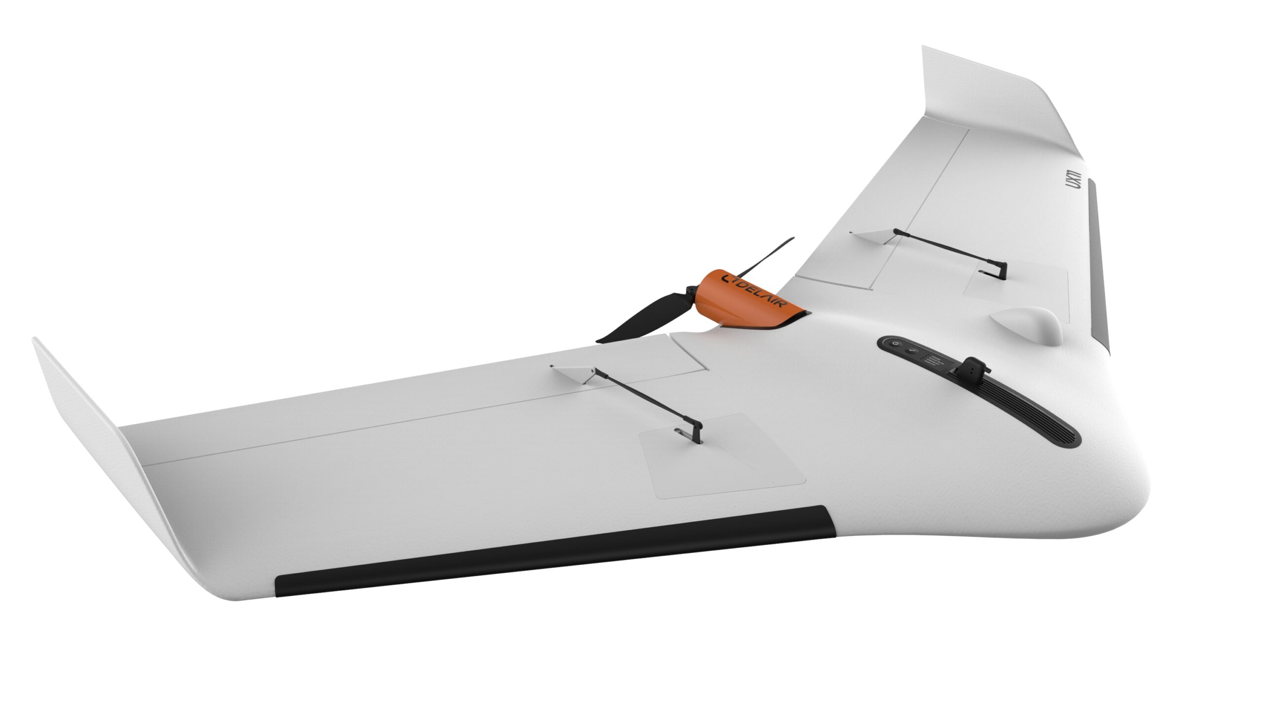
DELAIR UX11 W/ PPK INCLUDING 3G
$10,000.00
Map large areas faster – cover 1.2 km² (300 acres) with 1.7 cm GSD at 122 m flight height. Industrial camera with PPK activation for survey-grade results down to 1 cm precision. Precise takeoffs and landings – high-angle (30 degrees) takeoffs and landings for use in confined areas, low-speed landing using distance measurement technology. Easy-to-use…
Description
The Delair UX11 is a professional-grade fixed-wing drone designed for large-area mapping and surveying.1 One of its key differentiating features is its cellular connectivity, which includes 3G/4G connectivity, providing a significant advantage in certain operational scenarios.
Key Features and Functionality
- Fixed-Wing Design: As a fixed-wing drone, the UX11 is highly efficient for covering vast areas in a single flight. It can fly for up to 59 minutes and cover over 300 acres at a typical mapping altitude of 400 feet.
- Dual Communication System: The drone’s communication is a standout feature. It operates with a redundant system that includes a traditional 2.4 GHz radio link for a range of a few kilometers, and an integrated 3G/4G cellular connection.
- Unlimited Range (with cellular coverage): The 3G/4G connectivity is a crucial feature that allows for Beyond Visual Line of Sight (BVLOS) operations, where permitted by regulations. This cellular link provides virtually unlimited range, as long as there is network coverage, allowing for real-time control and monitoring of the drone over long distances.
- High-Accuracy Data Collection: The UX11 is equipped with a high-resolution, 21.4-megapixel global shutter camera. It also features a dual-frequency GNSS sensor (L1/L2) with Post-Processed Kinematic (PPK) capabilities. This allows for centimeter-level accuracy with minimal or no ground control points (GCPs).
- Ease of Use: The system is designed for simplicity. It is hand-launched and uses an automated belly landing with a deep-stall approach, allowing it to land in small or complex areas. Mission planning and flight management are handled via the user-friendly Delair Flight Deck Android app.
- In-Flight Data Management: A major benefit of the 3G/4G connectivity is the ability to perform in-flight data quality checks. The system can transmit a live video feed to the operator and even do some onboard processing and data quality checks, such as blur detection or overlap checks, to ensure the data is suitable for photogrammetry before the flight is even over.
Applications: The Delair UX11 with 3G/4G is ideal for professional applications that require mapping large and linear areas with high accuracy, such as:
- Infrastructure inspection (power lines, pipelines)
- Large-scale surveying and topographic mapping
- Precision agriculture and forestry management
- Mining and quarry operations
The Delair UX11 is a highly productive fixed-wing drone distinguished by its integrated 3G/4G cellular connectivity, which provides extended flight range and real-time data monitoring capabilities, making it a powerful tool for large-scale, high-precision mapping missions.
Related products
-
")
DEMO Sony ILX-LR1 (61MP) on Custom Gimbal 35mm lens (SkyScout Setup)
$5,000.00 -
")
DEMO WISPR SkyScout Pro w/ Black Herelink
$7,500.00 -

DEMO Ranger Pro 1100 Package
$15,000.00 -

+mdLiDAR (Payload only)
$20,000.00 -

DEMO MICRODRONES MDMAPPER 1000
$7,500.00
Reviews
There are no reviews yet.