Your cart is currently empty!
The “One-Stop-Shop Drone” for Surveying. Check out the all new WingtraRAY.
+mdLiDAR (Payload only)
$20,000.00
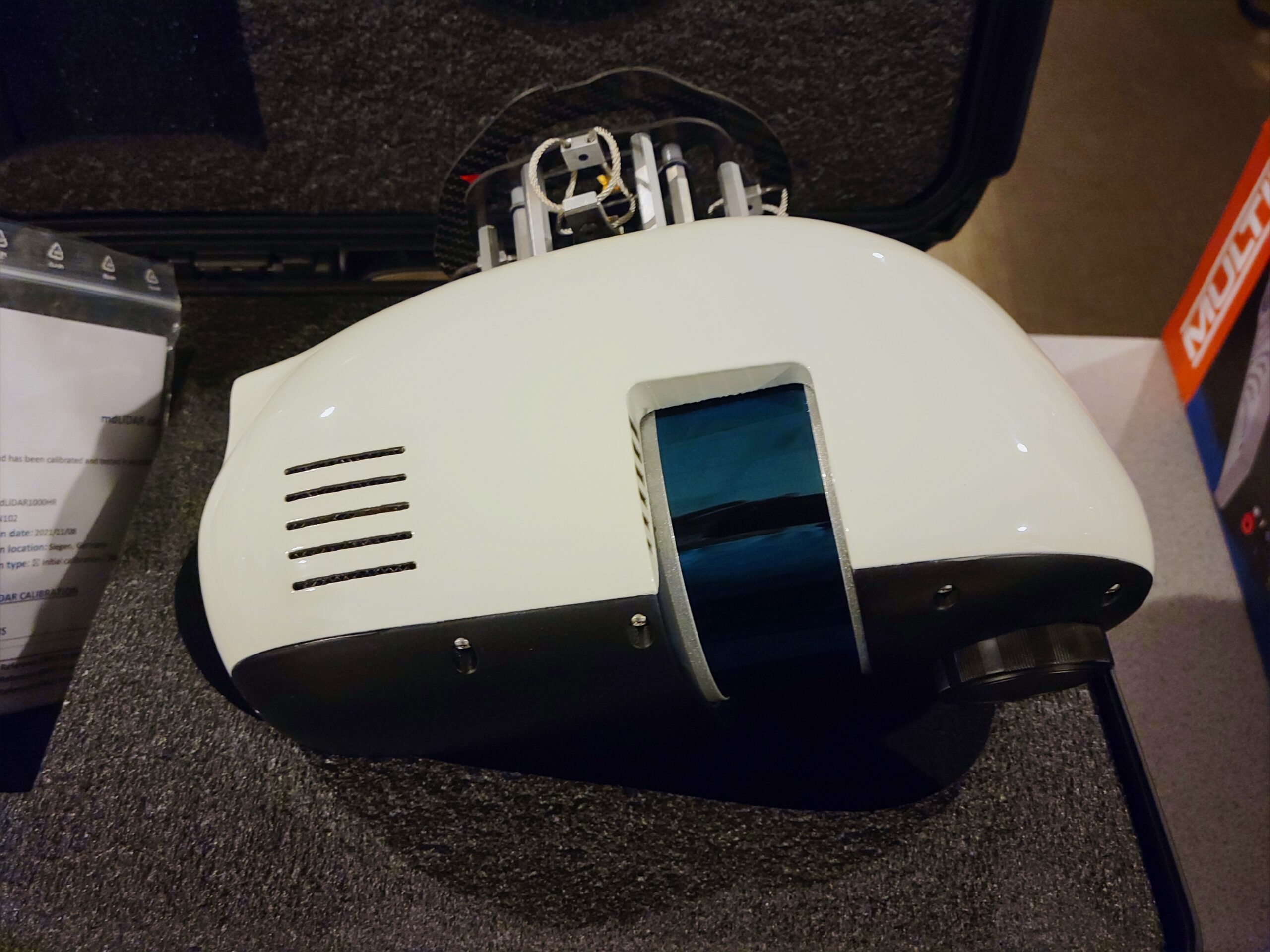
The Microdrones mdLiDAR payload is an advanced LiDAR sensor and camera system designed to be mounted on a Microdrones airframe. It is a key component of the company’s complete end-to-end LiDAR solution, but it can be acquired as a standalone unit.
Description
Key Features and Components
- LiDAR Sensor: The payload incorporates a high-performance LiDAR sensor, capable of capturing hundreds of thousands of points per second. This rapid data acquisition is crucial for creating highly detailed and dense 3D point clouds.
- Direct Georeferencing: A central feature of the payload is the integrated Applanix APX-15 UAV DG, which includes a survey-grade GNSS receiver and a precisely calibrated IMU. This hardware enables Direct Georeferencing, which provides accurate position and orientation data for every point collected, significantly reducing or eliminating the need for ground control points.
- Integrated Camera: The payload also includes a high-resolution camera, typically a Sony or a custom Microdrones CMOS sensor. This camera is calibrated to work seamlessly with the LiDAR data, allowing for the colorization of the final point cloud and the creation of photogrammetry-based deliverables.
- Robust and Integrated Design: The payload is housed in a rugged, lightweight casing that protects the sensitive electronics from the elements. Its design ensures a secure and quick connection to the drone’s power and data systems, making it easy to swap payloads for different missions.
Workflow and Performance
When used as part of the full Microdrones system, the payload’s workflow is highly automated. The user plans the mission in the mdCockpit software by setting flight altitude, speed, and desired point density. The drone then flies the mission autonomously while the payload captures the LiDAR and image data.
After the flight, the raw data is processed using the mdInfinity software suite. The software uses the DG data to precisely georeference the point cloud, align the images, and perform other tasks like point cloud colorization. This streamlined process results in high-quality deliverables with survey-grade accuracy.
In summary, the mdLiDAR payload is a sophisticated piece of hardware that combines a powerful LiDAR sensor, an integrated Direct Georeferencing module, and a high-resolution camera. As a standalone unit, it is designed to seamlessly integrate with Microdrones’ drones and software, allowing professionals to capture accurate and detailed 3D point clouds with minimal effort.
Related products
-
")
DEMO Sony ILX-LR1 (61MP) on Custom Gimbal 35mm lens (SkyScout Setup)
$5,000.00 -
")
DEMO WISPR SkyScout Pro w/ Black Herelink
$7,500.00 -

DEMO Ranger Pro 1100 Package
$15,000.00 -

Microdrones mdMapper 1000 DG
$15,000.00 -
DEMO MICRODRONES MDMAPPER 1000
$7,500.00
Reviews
There are no reviews yet.