Your cart is currently empty!
American Built, Affordable Price. Check out the all new TrueView1 LITE
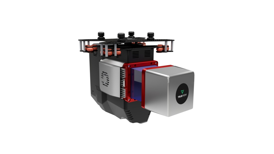
TrueView 625 Traditional + Software
$90,000.00
The TrueView 625 is a high-performance drone LiDAR and imaging system featuring the RIEGL miniVUX-3UAV sensor and dual 20 MP cameras. It delivers survey-grade accuracy, high-density point clouds, and detailed photogrammetry for applications such as utility mapping, forestry, and precision surveying.
Description
The TrueView 625 is a powerful LiDAR and photogrammetry solution designed for professionals who need precision, efficiency, and reliability in aerial mapping. Equipped with the RIEGL miniVUX-3UAV LiDAR scanner, it captures high-density point clouds with industry-leading accuracy. The dual 20 MP cameras enhance photogrammetry capabilities, producing sharp RGB imagery for colorized point clouds and detailed mapping. Optimized for UAV deployment, the TrueView 625 is an excellent choice for corridor mapping, vegetation management, and infrastructure assessments.
Key Features:
- Survey-Grade Accuracy – Utilizes the RIEGL miniVUX-3UAV for high-precision LiDAR scanning.
- Dual 20 MP Cameras – Captures high-resolution RGB imagery for photogrammetry and colorized point clouds.
- Optimized for UAVs – Lightweight and designed for seamless integration with multirotor drones.
- Advanced Data Processing – Compatible with LP360 software for automated classification, feature extraction, and analysis.
Related products

PIX4Dcatch Professional 3-year Rental
$3,990.00-
PIX4Dcatch Professional Monthly Rental
$199.00 ")
Sentera 6XT-640R Thermal – IF800 Payload
$22,500.00
WISPR 24MP Mapper (SkyScout set up)
$3,300.00
Sony ILX-LR1 (61MP) 55mm lens (SkyScout)
$9,500.00