Your cart is currently empty!
American Built, Affordable Price. Check out the all new TrueView1 LITE


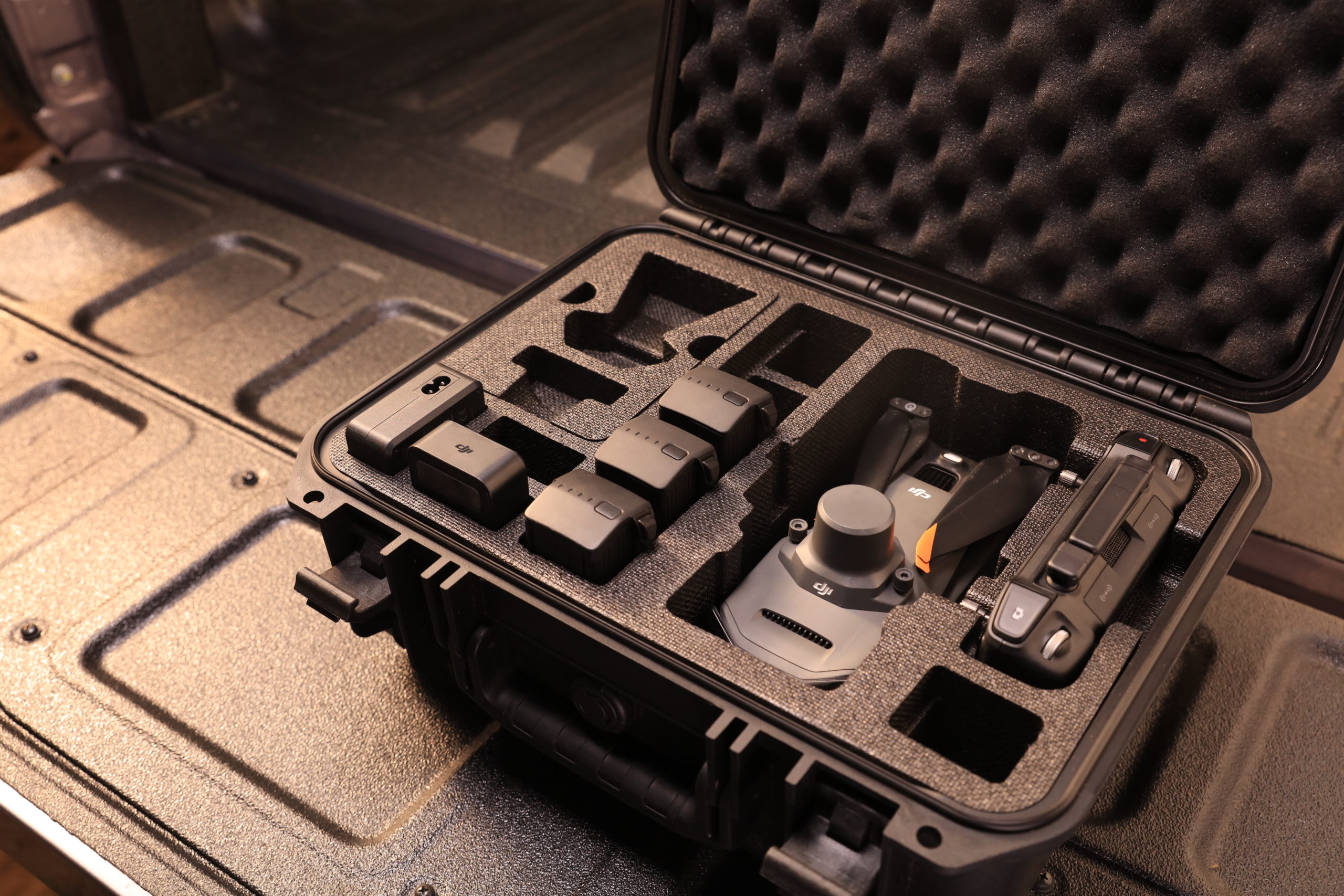
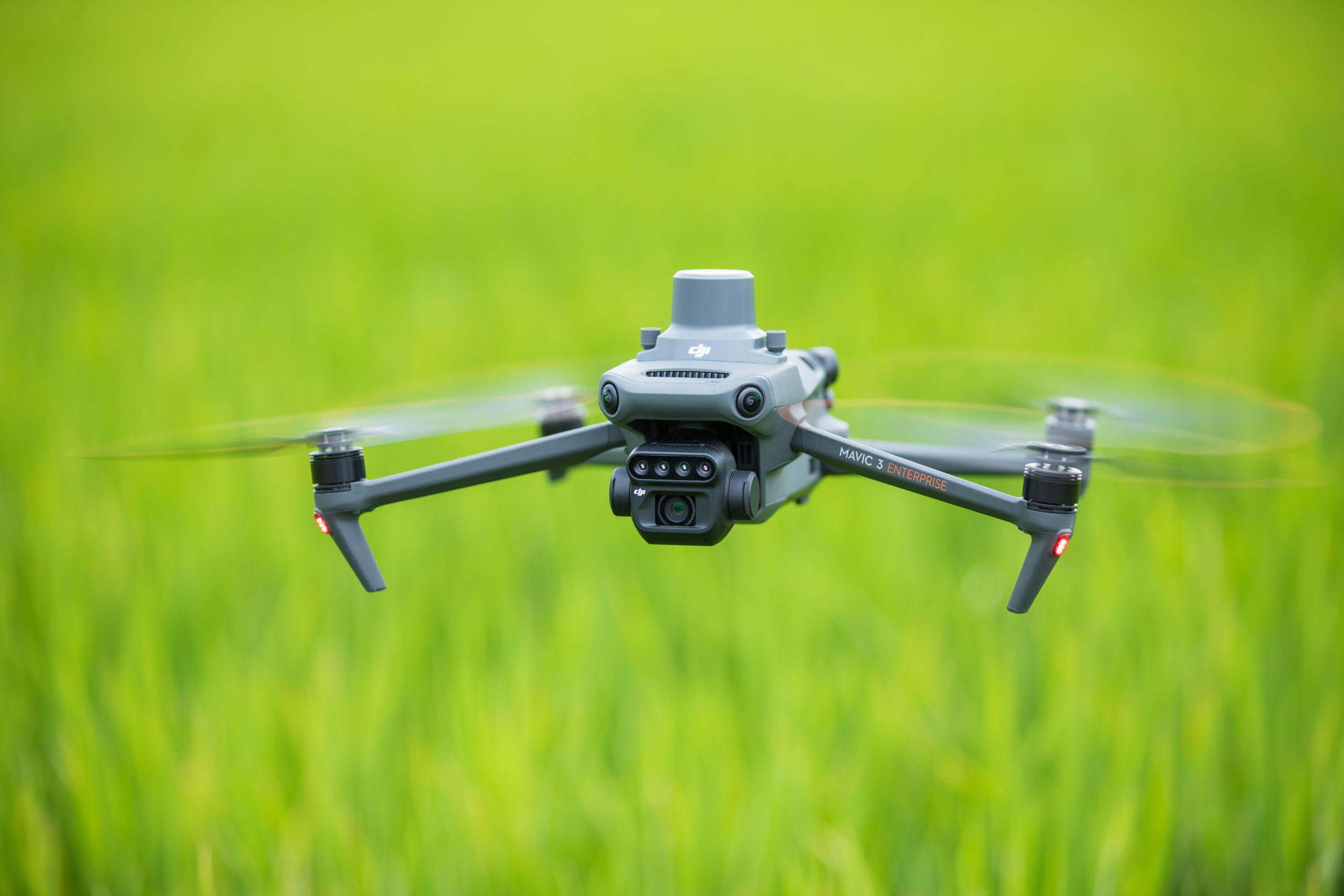
DJI Mavic 3 Multispectral
Effective aerial surveying needs to see the invisible. That’s why Mavic 3 Multispectral has two forms of sight. It combines an RGB camera with a multispectral camera to scan and analyze crop growth with total clarity. Agricultural production management requires precision and data, and Mavic 3 Multispectral delivers both. Highlights: Compact and Portable – foldable…
Description
Multispectral + RGB imaging system
Highly integrated imaging system
Newly upgraded imaging system with one 20MP RGB camera and four 5MP multispectral cameras (green, red, red edge, and near infrared).
Enables applications such as high-precision aerial surveying, crop growth monitoring, and natural resource surveys.
5 MP Multispectral Camera
- Near-infrared (NIR) – 860 nm ± 26 nm
- Red edge (RE) – 730 nm ± 16 nm
- Red (R) – 650nm ± 16nm
- Green (G) – 560nm ± 16nm
Sunlight Sensor
The built-in sunlight sensor captures solar irradiance and records it in an image file, allowing for light compensation of image data during 2D reconstruction. This results in more accurate NDVI results, as well as improved accuracy and consistency of data acquired over time.
RTK module
Accurate images that capture every pixel
Mavic 3M with RTK module for centimeter-level positioning. Flight control, the camera, and the RTK module sync in microseconds to accurately capture the location of each camera’s imaging center. This enables Mavic 3M to do high-precision aerial surveying without using ground control points.
Omnidirectional obstacle sensing, terrain-follow aerial surveying
The aircraft features multiple wide-FOV vision sensors that accurately detect obstacles in all directions for omnidirectional obstacle avoidance. The terrain-follow aerial surveying can be easily performed in steep-slope landscapes.
Orchard mapping
Mavic 3M allows terrain-follow aerial surveying of orchards, even on sloped landscapes. Together with DJI Terra or DJI SmartFarm Platform** to reconstruct high-resolution orchard maps, automatically identify the number of trees, distinguish trees from other obstacles or objects, and generate three-dimensional operation routes for agricultural drones, making operations safer and more efficient.
Guide variable rate applications
For rice fertilization, cotton growth regulation, and potato foliar fertilizer spraying, the Mavic 3M is used to obtain multi-spectral images of crops. DJI Terra or the DJI SmartFarm Platform** can then generate NDVI and other vegetation indices maps, capturing differences in crop potential and generating prescription maps that allow agricultural drones to execute variable-rate application. This ultimately allows users to reduce costs, increase yield, and protect the environment.
Intelligent field scouting
The Mavic 3M can carry out automatic field scouting. The field scout images can be uploaded to the DJI SmartFarm Platform** in real time through a 4G network. It can find abnormalities, such as emergence deficiencies, weed pressure, and crop lodging in a timely manner. It can also conduct intelligent analyses, such as cotton seedling identification and rice production testing, using AI identification for real-time sharing of crop growth information, guidance of agronomic activities, and easy management of 70 hectares of farmland by one person.
* Specific test conditions: In a sunny environment without wind, the orthographic flight aerial photography is obtained with a flight speed of 15 m/s, a flight altitude of 217 m, a ground sampling distance (GSD) of 5.73 cm for visible and 10 cm for multispectral, a fore-and-aft overlap rate of 70%, and a side overlap rate of 60%.
** The DJI Smart Agricultural Platform will be supported in Q2 of 2023. This service is not available in some countries. Please consult us for details.


")
Reviews
There are no reviews yet.