Description
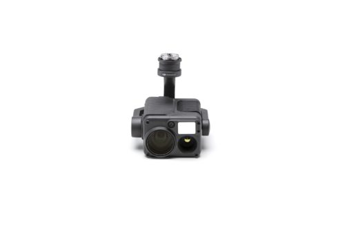
DJI Zenmuse L3 LiDAR & RGB Mapping Payload
The DJI Zenmuse L3 sets a new standard for aerial LiDAR and photogrammetry performance, combining advanced long-range LiDAR technology with high-resolution RGB imaging to deliver unmatched accuracy, efficiency, and data reliability.
Engineered for professional surveyors, engineers, and mapping specialists, the Zenmuse L3 is designed to handle complex environments with confidence — from dense vegetation and rugged terrain to large-scale infrastructure and corridor mapping projects. Its powerful LiDAR system provides superior point density and enhanced ground penetration, enabling precise elevation models and detailed surface analysis even in challenging conditions.
Paired with integrated RGB cameras and an improved positioning and orientation system (POS), the L3 ensures accurate georeferencing and high-quality visual context, streamlining workflows from data capture through final deliverables. The result is cleaner point clouds, reduced post-processing time, and greater confidence in every dataset.
Key Benefits:
-
Long-range LiDAR scanning for large-area and complex terrain mapping
-
High-resolution RGB imagery for detailed visual documentation
-
Improved accuracy and reliability for survey-grade applications
-
Enhanced vegetation penetration for clearer ground models
-
Optimized for efficiency to reduce flight time and increase coverage
-
Seamless integration with DJI enterprise platforms and workflows
Whether you’re performing topographic surveys, construction progress monitoring, volumetric analysis, or infrastructure inspections, the Zenmuse L3 provides the performance and precision professionals need to make faster, smarter decisions in the field.
Available through Seiler GeoDrones with expert support, training, and turnkey workflow integration.
Reviews
There are no reviews yet.